
From Trogir to Dubrovnik
A History of the Dalmatian Coast
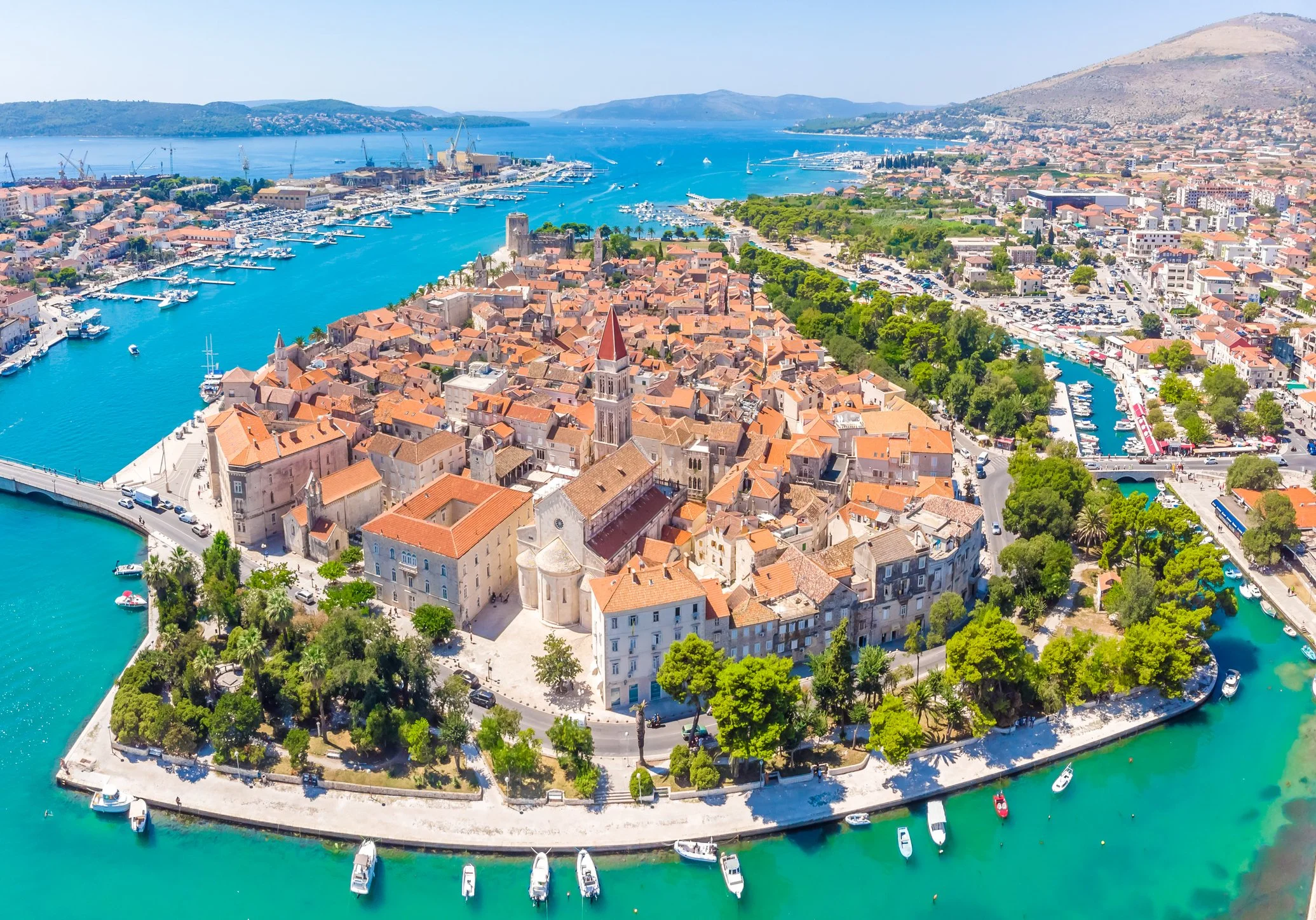
UNESCO World-Heritage listed Trogir, Croatia
Follow the coast from Trogir to Dubrovnik, and each town hands you a different chapter of the Adriatic's history
In 229 BCE, Rome sent envoys across the Adriatic to complain about piracy. Queen Teuta of the Illyrians, who ran her kingdom on it openly, had one of them killed. Rome declared war, crossed the sea, and never really left.
Follow the coast from Trogir to Dubrovnik, and each town hands you a different chapter of that history. Life along the eastern Adriatic was shaped more by the sea before it than by the mountains at its back. The Illyrians were here first; then the Greeks came in search of fertile ground; the Romans imposed order; the Venetians turned harbours into instruments of trade; and the Ottomans pressed down from the inland heights. Each power arrived by water, left its mark on the shore, and gave way to the next.
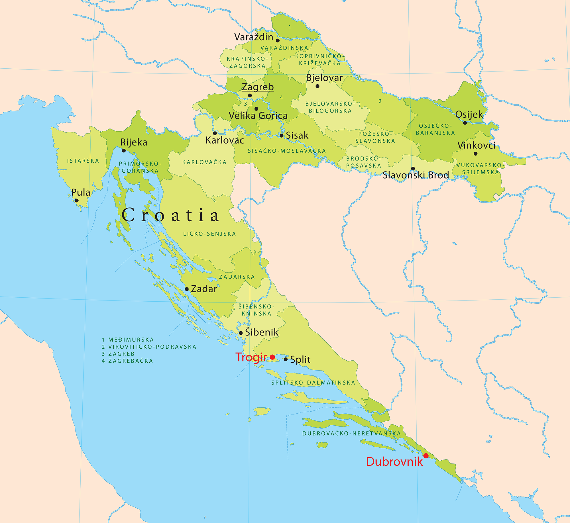
Map of Croatia, highlighting the location of Trogir and Dubrovnik
Seen from the water, the coast shows this legacy at its most glorious: white limestone towns stacked above water, terracotta roofs running down to the quays, and the cathedrals and bell towers, the fortress walls and customs houses all facing the sea, as though still waiting for the merchant fleets and ambassadors who, for two and a half millennia, came from the sea. What remains is a chain of coastal towns, from Trogir in the north to Dubrovnik in the south. Their history reads in sequence, harbour by harbour, with the sea itself the thread that runs through it. These are the stories each place still tells.
Trogir: the Middle Ages intact
The story begins at Trogir. Set on a narrow islet between the shore and the larger island of Čiovo, the town has been inhabited for more than two thousand years: founded by Greek colonists in the third century before the common era, incorporated into the Roman Empire as Tragurium, and brought to its height under Venetian rule. What sets it apart is the completeness with which it has kept its medieval form. Its street plan is among the most intact on the Adriatic, a compact mesh of lanes, courtyards and palaces scarcely altered in seven centuries, so that to walk it is to move through a town much as a traveller of the Middle Ages would have found it.
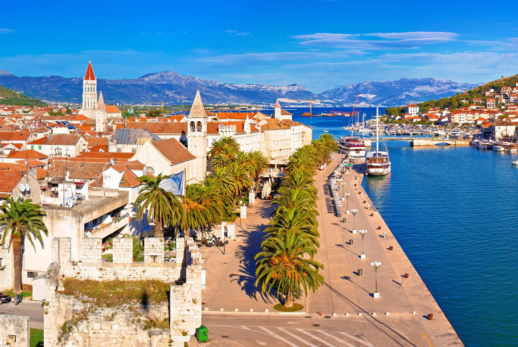
Trogir waterfront
At its centre stands the Cathedral of Saint Lawrence, begun in the thirteenth century and crowned by Radovan's Romanesque portal, one of the supreme works of medieval sculpture in Dalmatia. Figures, beasts, saints and biblical scenes are carved across the stone, and the doorway feels less like an entrance than a threshold between worlds. Trogir is itself a kind of threshold: the point where the mainland releases you to the Adriatic and the coast begins to tell its story by sea. It sets the pattern for what follows, a coast where the past was never swept away but lived in and handed on, century after century.
The town wears its history in plain sight. The cathedral's bell tower, two centuries in the making, rises from a Gothic ground floor through a richly Venetian second storey to a Renaissance crown, a single tower that records three centuries of changing taste. Opposite the cathedral and the council chamber stands the Cipiko palace, the home of the town's leading family, set there deliberately to face the seats of Church and commune. At the western tip of the islet, where the town meets open water, the Venetians raised the Kamerlengo fortress in the fifteenth century to watch over the harbour and the channel beyond.
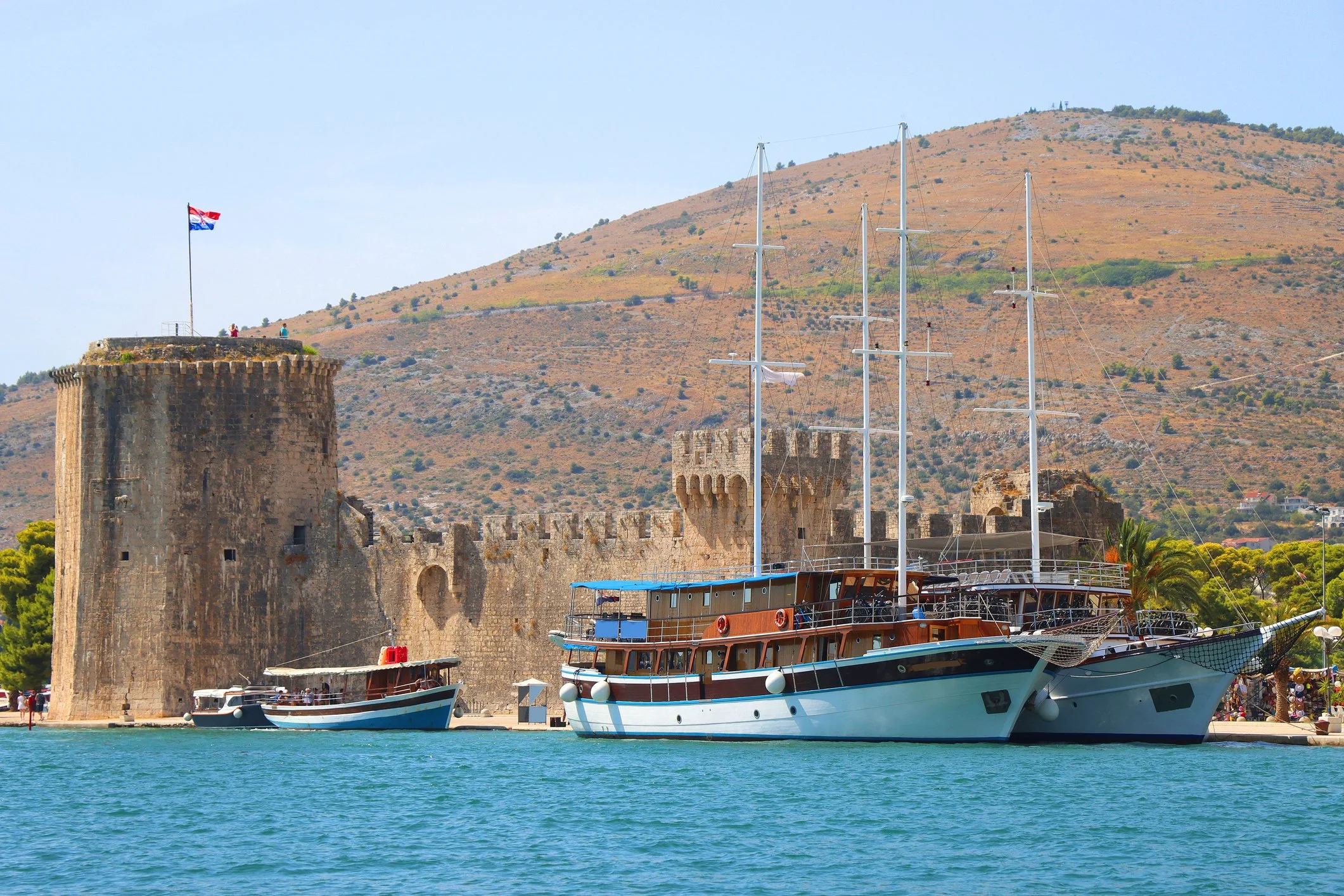
Kamerlengo fortress, Trogir
Greek, Roman and Venetian in turn, Trogir holds them all within a few hundred metres of pale, weathered limestone, and the same long layering waits on every island beyond.
Hvar: the Greek field and the Venetian harbour
South across the channel lies Hvar, home to the oldest surviving landscape on the coast. In the fourth century before the common era, Greek colonists from Paros founded a settlement they called Pharos, on the site of present-day Stari Grad. On the plain behind it they laid out a working colony, dividing the fertile ground into rectangular plots bounded by low drystone walls, with fields, paths and water channels ordered to a plan. It is the plan itself that has endured, long after the colony and its founders were gone. That grid, the Stari Grad Plain, survives and is farmed still in almost the arrangement the Greeks gave it twenty-four centuries ago.
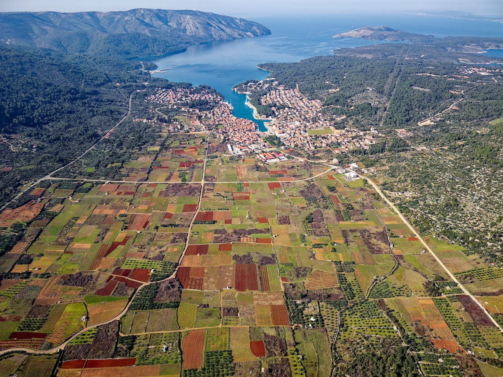
View of Stari Grad Plain, Hvar Island
It ranks among the oldest agricultural landscapes anywhere in the Mediterranean, a place where, standing among the olives and vines, you can read, in the run of the walls, the working decisions of an ancient surveyor.
Hvar Town, around the headland, belongs to a later age: a Venetian harbour of Renaissance palaces, set on one of the largest public squares in Dalmatia, made prosperous by the trade Venice drove through it. Yet it is the field walls of Pharos that hold the eye, not a monument at all, but twenty-four centuries of ordinary work.
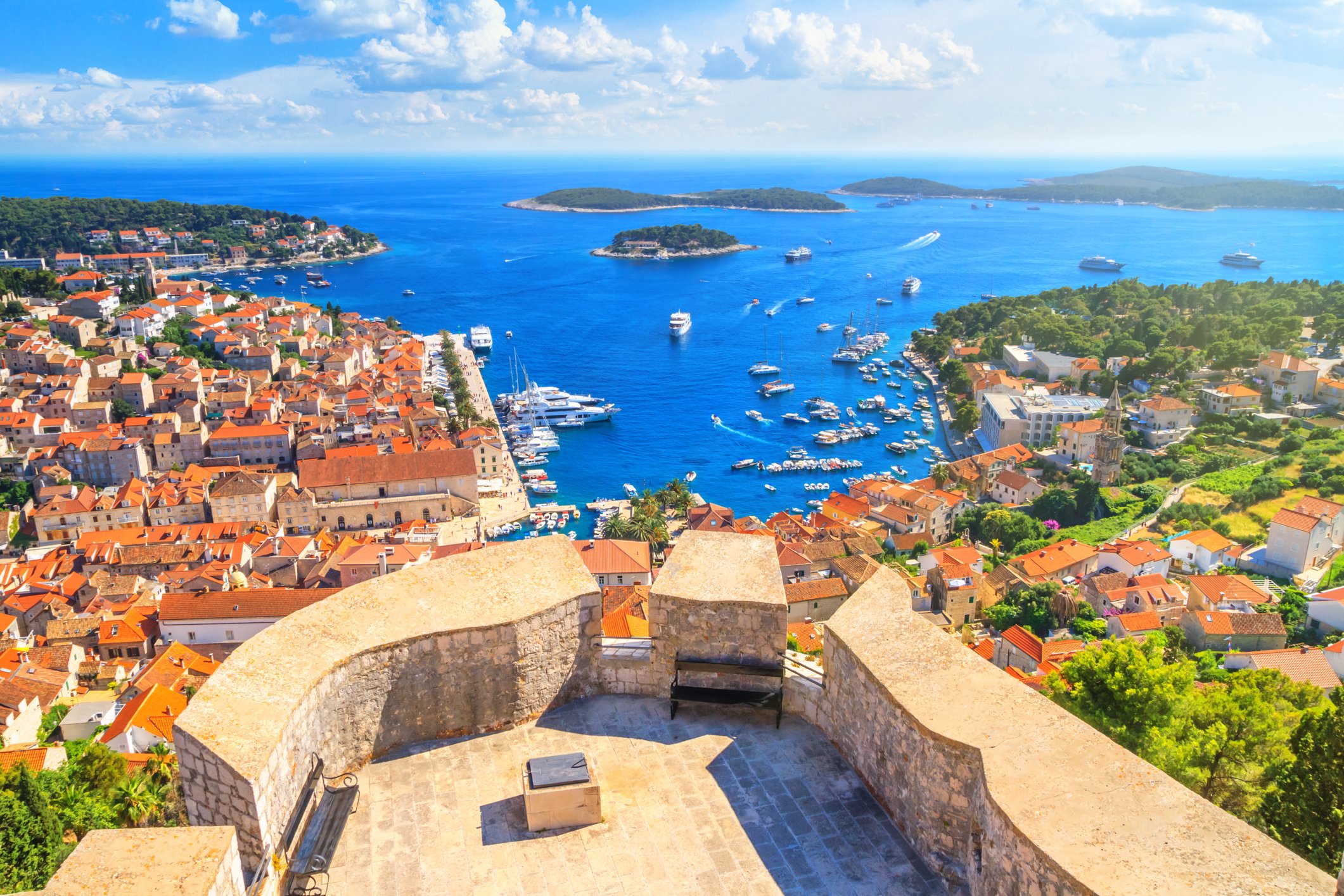
View of Hvar from the fortress
Hvar's position made it valuable to every power that passed. Its deep, sheltered bays gave anchorage to the fleets that worked the Adriatic trade routes, and by the fifteenth and sixteenth centuries, the island had grown rich enough to raise the fortifications that still climb the hillside above the town, and the arsenal in which Venetian galleys were repaired and refitted. Above the harbour, a theatre opened in 1612, among the oldest surviving public theatres in Europe, set directly over that arsenal, so that the commercial and the civic life of the island stood one upon the other in a single building. Between the Greek field grid and the Venetian theatre lies the whole span of Hvar's history: the inland plain where the Greeks first broke the soil, and the seaward town where Venice, centuries later, made its fortune.
Vis: the island time kept apart
Further out to sea than any other major island lies Vis, whose history runs deeper than its quiet harbour suggests. In 397 BCE Dionysius the Elder, tyrant of Syracuse, founded a colony here called Issa, the first Greek settlement on the eastern Adriatic. Issa grew into a polis in its own right, minting its own coins and, in turn, founding colonies along the coast, among them Aspálathos, the settlement that would one day become Split. For a few centuries, this small island was not a backwater but a mother-city, sending out its own settlers. It was Issa that brought Rome to this coast: besieged by Teuta's Illyrians, the islanders appealed to the Senate, and the legions that answered made the Adriatic a Roman concern for good. Byzantium and then Venice followed, and Issa slipped into the long quiet of a minor port, its Greek walls and Roman theatre left to be quarried for later building.
The chapter that shaped modern Vis, though, is the most recent, and the most unexpected. In 1944 the island became the headquarters of Tito's Partisans, the one Adriatic island the Germans never took, defended by the Partisans alongside British and Allied forces who flew fighters from a rough airstrip and raided the occupied islands nearby. After the war, Vis was turned into one of the Yugoslav navy's main bases and closed to outsiders altogether; foreigners were barred from the island until 1989, and the hills were hollowed out with tunnels, gun emplacements and submarine pens, some of which can still be visited.
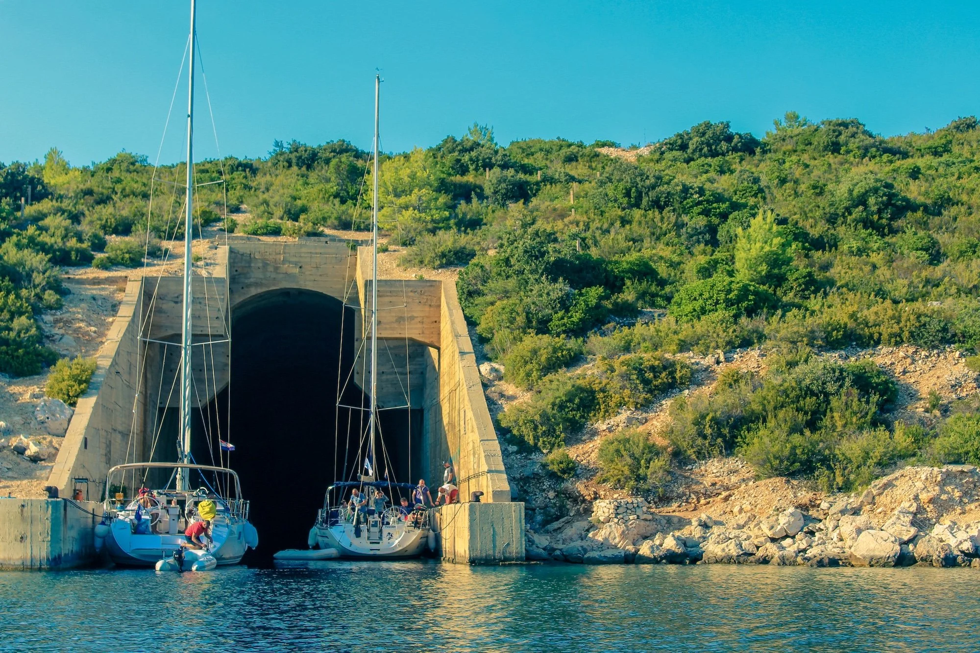
Military submarine tunnel on Vis island
While tourism remade much of the Dalmatian coast, Vis was held apart, its old stone houses, fishing harbours and terraced vineyards left as they were. The island still grows Vugava, a white grape found almost nowhere else, on hand-worked slopes. Offshore, on the neighbouring islet of Biševo, the Blue Cave fills at midday with a strange blue light, thrown upward through a submerged opening until the water seems lit from within.
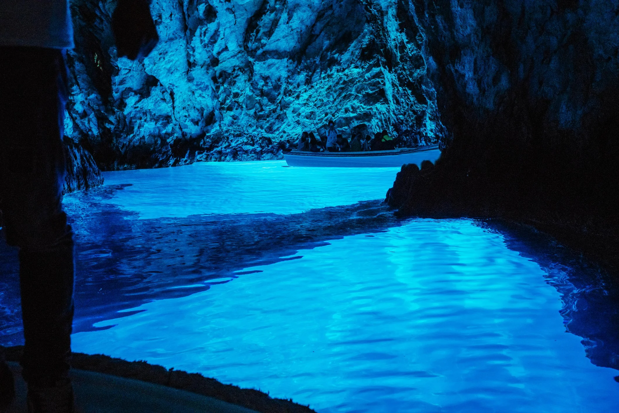
Biševo Blue Cave
On a busier coast it would long since have been overrun. On Vis, isolation did the work of preservation, leaving Greek ruins, a British military cemetery and a Cold War naval base layered together on a single small island.
Korčula: stone, wind and wine
South again lies Korčula, the most deliberately planned of all the islands' towns. Known to the ancient Greeks as Korkyra Melaina, Black Corfu, for the dark pine forests that once cloaked it, the island grew under Greek, Roman and then Venetian rule into a centre of seafaring and trade, its walled old town set on a narrow peninsula that pushes into the water like the prow of a ship. Its streets were laid in a herringbone, every lane angled to draw the cool summer breeze through the town while turning the bitter winter wind aside before it could reach the centre. This is town planning as a careful bargain with the elements, struck by people who lived intimately with the wind.
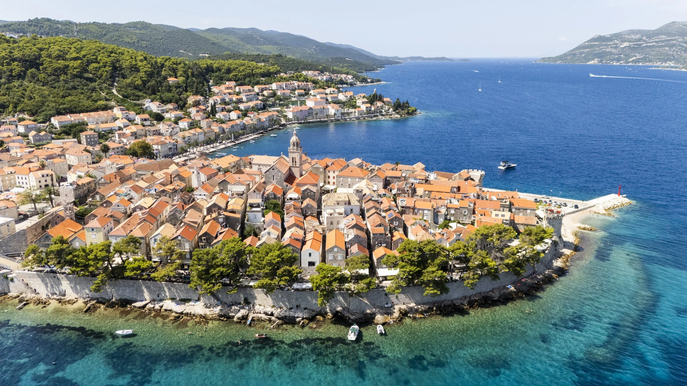
Korčula, nestled along the Adriatic coastline
Within the walls, the town was built and rebuilt by Korčula's stonemasons, the most renowned in Dalmatia, who quarried pale stone from the nearby islets of Vrnik and Badija and raised the Cathedral of Saint Mark at the town's heart, a fifteenth-century work in which Gothic begins to soften into Renaissance. Their craft survives in the carved portals, rose windows and bell towers of the old town, and in the wines of the surrounding vineyards, which yield Pošip and Grk, made almost nowhere else on earth.
Korčula's strongest tie to the wider world is Marco Polo: in 1298, in a sea battle fought just off the town, a Genoese fleet defeated the Venetians and captured Polo, then commanding a Venetian galley. It was in the prison that followed that he dictated the account of his travels. The island also claims him as a native son, a claim history cannot confirm but one that suits a town shaped by voyages. And what the town has kept is not only stone: every summer the streets still fill with the Moreška, a sword dance of clashing blades that Korčula has kept since at least the seventeenth century.
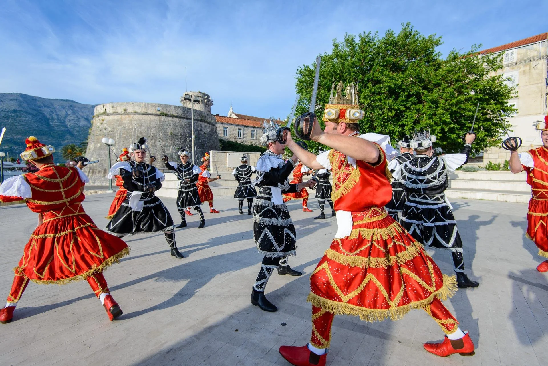
The Moreška – a sword dance on the island of Korčula
Of all the islands, Korčula is the one where the old republic is not remembered but rehearsed, every summer, blade on blade.
Mljet & Ston: at the edge of the republic
South of Korčula sits Mljet, among the most densely wooded islands in the Adriatic, which gives over half its length to a national park; at its northwestern end, the sea has reached inland through drowned limestone valleys, forming saltwater lakes where the pines lean almost to the water. On a small islet within one of those lakes, Benedictine monks built a monastery in the twelfth century. They came because the place was remote, after the solitude that only an island within an island can offer, and that same remoteness is what has kept the island's forests and waters as they are.
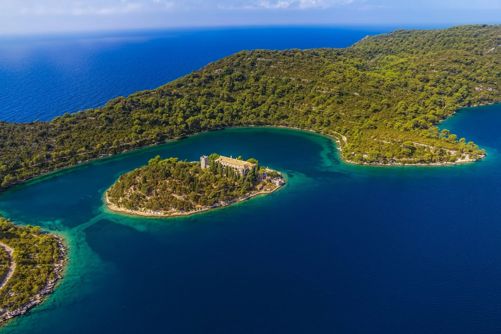
St Mary's island on Mljet
Nearby, on the Pelješac peninsula, Ston's history runs older still. Salt has been harvested from its shallow pans since antiquity, and in the calm waters of Mali Ston's bay, oysters have been cultivated since Roman times, in beds still worked today. It was the salt that drew the Republic of Ragusa, which acquired the peninsula in 1333, not by conquest but by purchase from the Serbian king, and set about defending its new territory in the manner it knew best.
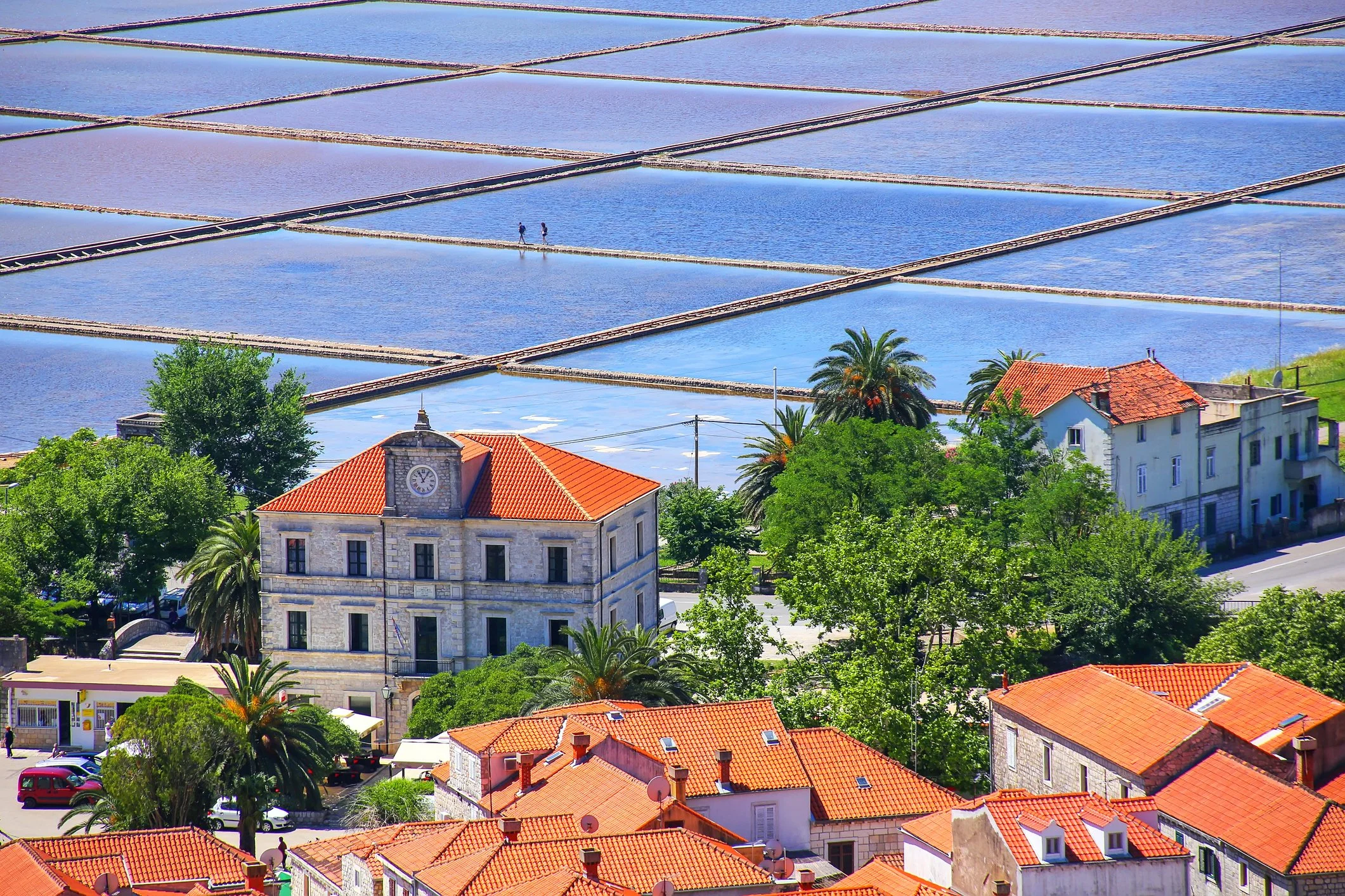
Salt pans in Ston town
Across the narrow neck of land it raised a chain of walls more than seven kilometres long, climbing the hillside between Ston and Mali Ston and studded with some forty towers and five fortresses, the longest such fortification in Europe. The walls sealed the peninsula against the Ottoman lands pressing in from Herzegovina and guarded the pans below, whose white gold supplied as much as a third of the whole republic's income. Salt was wealth, and wealth had to be walled.
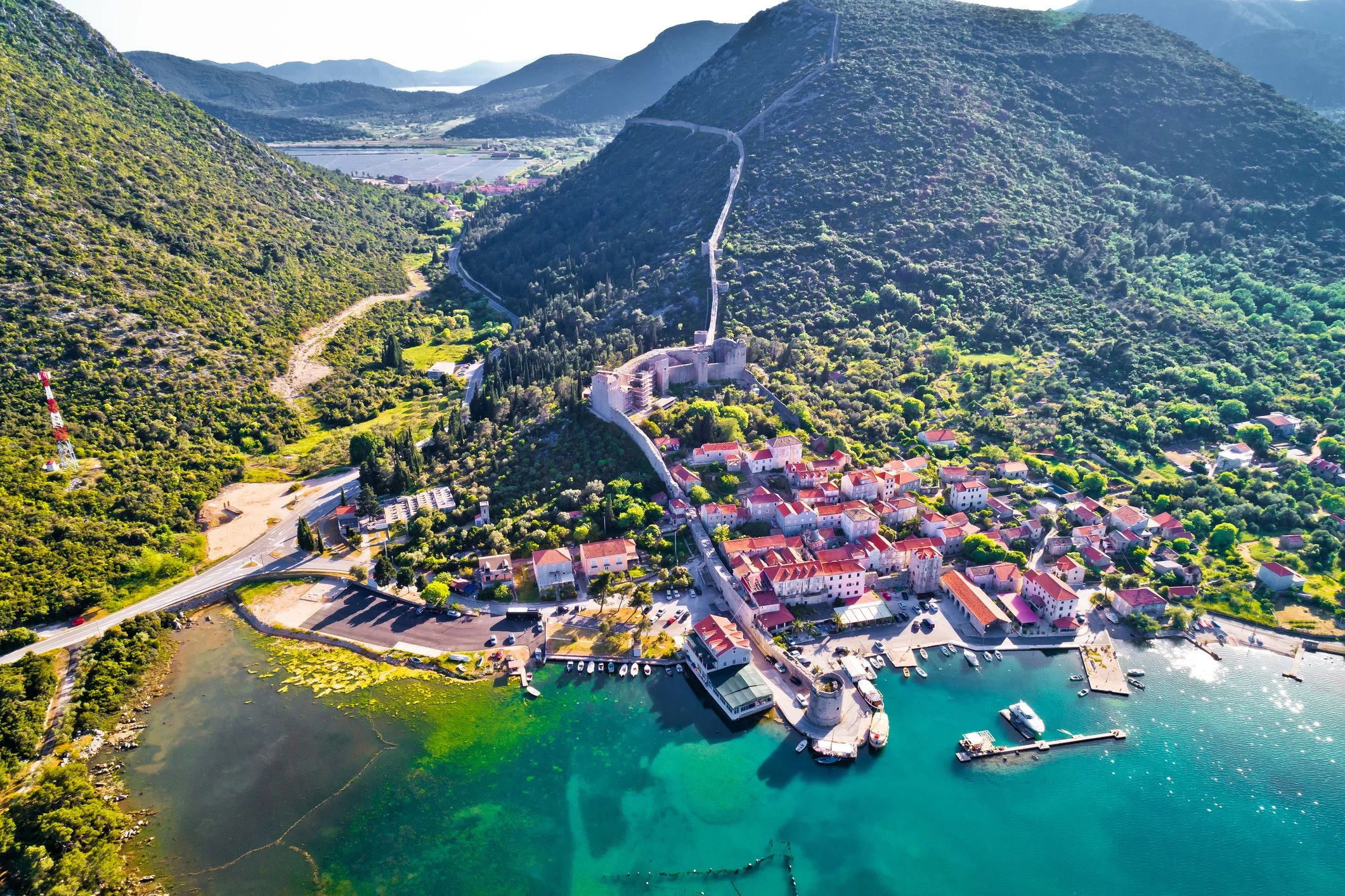
View over the Ston walls
Mljet and Ston together mark the approach to Dubrovnik: the one all forest and monastic quiet, the other all salt and stone. Both belong to the world of the great republic just ahead.
Dubrovnik: Ragusa, the rival of Venice
The story ends at Dubrovnik. For close to five centuries this was not a Croatian town at all but an independent state, the Republic of Ragusa, the one power on the eastern Adriatic that could rival Venice. It had little territory and no army to speak of. What it had was a merchant fleet that ranged the length of the Mediterranean and out into the Atlantic and the Black Sea, and a gift for diplomacy that kept it alive among empires many times its size.

The medieval Old Town of Dubrovnik
The rivalry with Venice lasted for centuries, and it was about trade above all. Ragusa had begun as a Venetian possession, paying tribute and serving as Venice's naval base in the southern Adriatic, and the resentment that grew out of those years hardened into a lasting enmity. When the Treaty of Zadar forced Venice to surrender its claims to Dalmatia in 1358, Ragusa slipped free, placing itself under the distant and undemanding sovereignty of the Hungarian crown and governing itself in all that mattered. From then on the two republics competed on every sea. Ragusan ships, helped by their nearness to the great oak forests that built and supplied them, undercut Venetian freight rates and carried cargoes the length of the Mediterranean; by the fifteenth century, Ragusa stood with England, Spain and Genoa among the most damaging competitors Venice had, even in the Adriatic that Venice liked to call its own. The competition was not always peaceful. Venetian galleys and Ragusan guns exchanged fire off the city as late as 1630, and through the seventeenth century, Venice spent freely to break the Ragusan carrying trade.
Ragusa could not match the powers around it in force and did not try. It secured its position by treaty instead. Encircled from the late fifteenth century by Ottoman territory, it agreed in 1458 to pay the Sultan an annual tribute, eventually fixed at some twelve and a half thousand gold ducats, in exchange for neutrality and the freedom to trade across the Ottoman lands at its back. Payment and negotiation came cheaper than any fleet. Its merchants doubled as its eyes, sending home word of Ottoman troop movements and Venetian designs, so that the republic was rarely caught unawares. Its motto put the principle plainly: liberty is not well sold for all the gold.
That same restraint shaped the city from the inside. Behind its great walls, still ringing the old town intact and walkable end to end, the Ragusans built a government designed to stop power gathering in any one pair of hands.
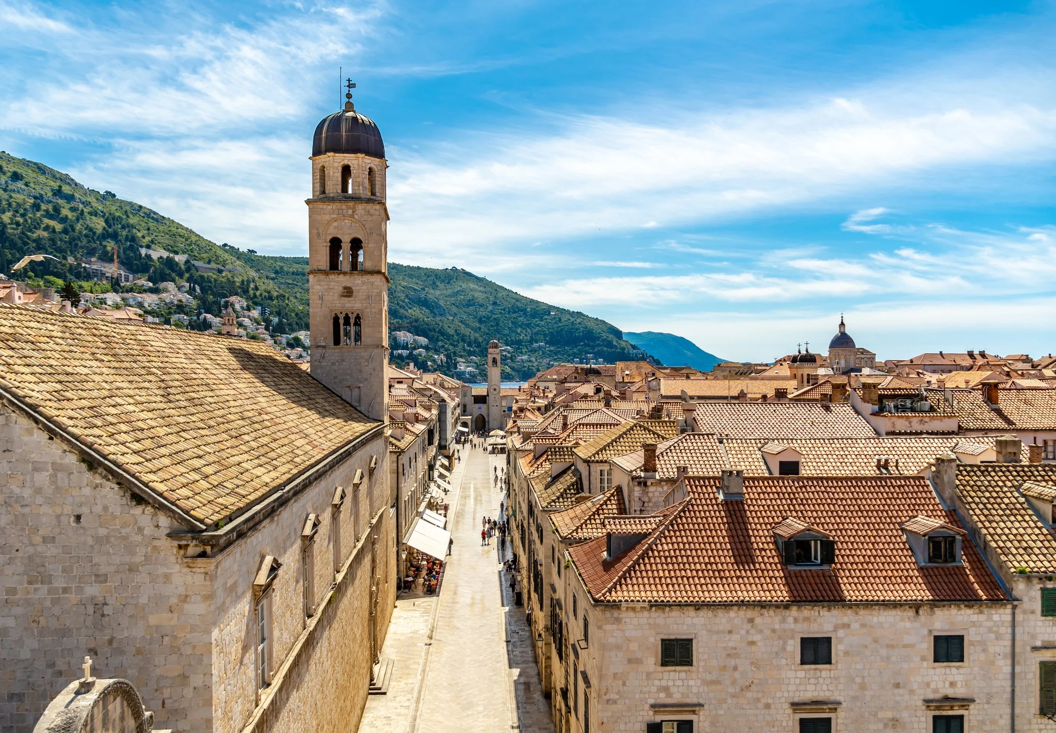
Franciscan Church and Monastery in Old Town Dubrovnik
Authority lay with an aristocratic council, and the Rector who nominally headed the state served a term of just one month, bound by rules that made him more figurehead than ruler, so that no single man or family could turn the republic to private ends. The same caution produced one of the earliest public health systems in Europe: from the fourteenth century, arriving ships and travellers were made to wait out a fixed period of isolation before entering the city, the forty days that gave quarantine its name. Walls, treaties, tribute, quarantine: everything Ragusa built was a hedge against forces larger than itself.
To arrive in Dubrovnik by sea, watching the walls rise from the water, is to see the city as the merchants and envoys of Ragusa did for five centuries. In the end, it outlasted its great rival: both republics fell to Napoleon at the turn of the nineteenth century, within a decade of one another, but Ragusa was the last to go.
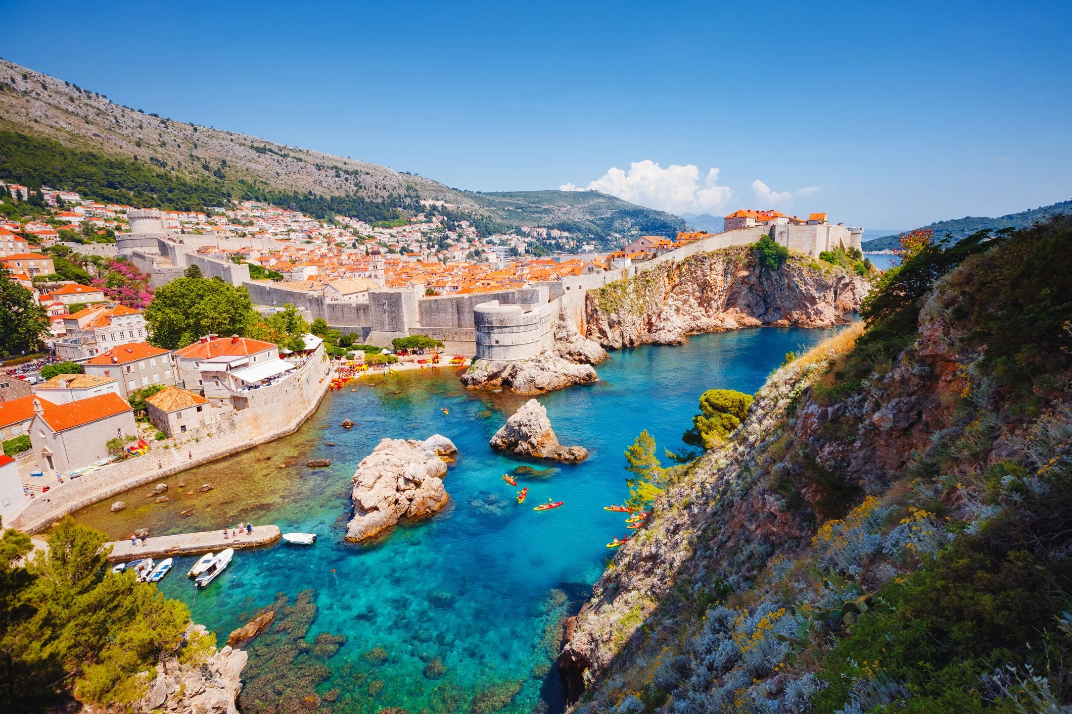
The Walls of Dubrovnik
The Dalmatian coast was shaped by communities who relied on the sea for their livelihood. Greeks introduced their fields, Romans built roads and walls, Venice established trade, and the Ottomans pushed from the mountains behind. Each left remnants that others did not erase. No single town contains the full history; it is preserved collectively across all of them. Travelling south along this route, from Trogir's alleys to Ragusa's walls, reveals the history of the eastern Adriatic as it was experienced–sea to land, from one town to the next.
The most authentic way to explore this history remains the oldest: by water, following the footsteps of Ilyrians, Romans, Greeks, Venetians, and Ragusan merchants.
coastal croatia
An Adriatic Journey by Land & Sea
Join Dr Lauren Mackay on this 15-day exploration of Croatia.
A highlight is a seven-night cruise aboard the privately chartered MV Avantura, sailing south from Trogir to explore the islands of Hvar, Vis, Korčula and Mljet, where expertly guided visits are balanced with time at leisure to enjoy the atmosphere of these historic harbour towns.
